 |
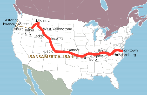
Yorktown, VA to Grangeville, ID Miles Ridden 3,455
Average 69 miles/day, Estimated Finish July 12, 2015 |
 |
| Biking Detail Powell, ID to Grangeville, ID |
Day 51 Wednesday, July 1
Left Colgate Lick at 5:45, 14 miles west of Powell. Nice quiet ride, cool temperature, no wind, downhill, and no traffic yet! Good hour to start riding along this stretch. Did have some logging trucks, all at once about 8 of them about 6:00 AM but then no more! Posted sign says 99 miles of curves, and that is the case.
Started out following the Lochsa River, very scenic Clearwater River canyon. Got to Powell about 9:00...made good time averaging close to 17 MPH. Had quick breakfast at the Wilderness Inn and back on the road to take advantage of the good riding conditions. Road is good, recently re-paved and nice to listen to and to follow the river all morning.
Stopped to by some smoke salmon from the Nez Perez Indians near Kooksia. Will be good with some cheese and wine! Had planned to stop for the day at Stites but got there at 11:30 so decided to push on to Grangeville even though it involved a 2,000 ft climb...late afternoon with temperature over 100! What was I thinking.
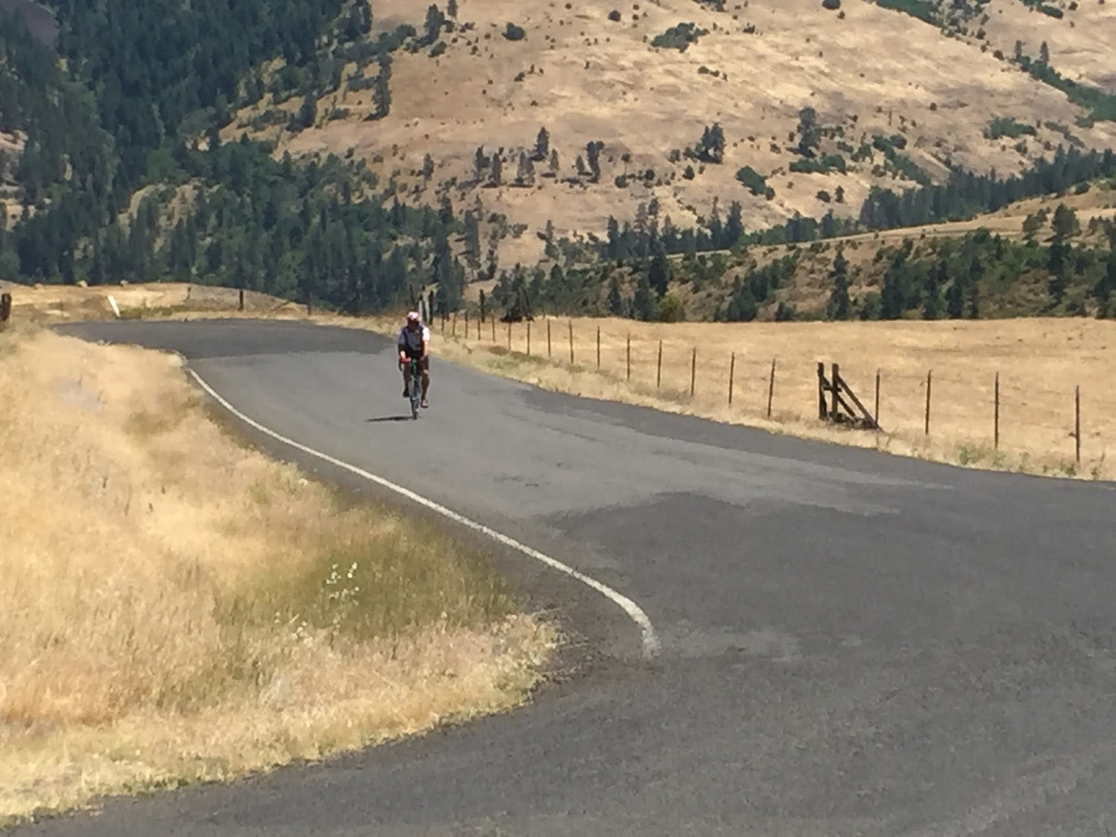
The climb was tough with the heat but the back road route thankfully was an unlined road with virtually no traffic. Hairpin switch backs in first few miles. Granny gear in full use. Got to the top of the ridge and still had about 12 miles to Grangeville. Roller coaster road through wheat fields. Passed two ladies, Peg and Elise from Michigan, doing the full Astoria to Yorktown trail, self-supported and on Day 21.
Got to Grangeville at 3:30 and got the last room in town (with four motels!) Big Fourth of July celebration starting tomorrow plus several fire fighters fighting a forest fire several miles away staying here. Walked across the street to a lounge for a cold beer even before the shower! 104 mile day and temperature got up to 104!
 |
| Biking along the beautiful Lochsa River |
 |
| I had three of these pass me, one on a curve, with oncoming traffic, what a thrill! |
 |
| Not really a shoulder for 100 miles |
 |
| Several of these foot bridges along the way |
 |
| Not sure if someone died or just moved away |
 |
| The Lochsa, and Selway join to form the Clearwater River |
 |
| Making good time to Stites, ID |
 |
| Getting to the bottom of the Clearwater Canyon, landscape is changing |
 |
| Stopped here to buy some Indian smoked Salmon |
 |
| 2,000 foot climb begins 7%-12% grade |
 |
| Nearing the top |
 |
| At least there is no traffic |
 |
| One last 12% challenge |
 |
| Panoramic view from the top |
 |
| Bikers Peg and Elise heading East on top |
 |
| Lots of wheat on the high plain |
 |
| View of Grangeville below the hills on the horizon...we climb these tomorrow |
 |
| Day finished, It's Miller Time |


No comments:
Post a Comment